

Location – mountain:
- Korab – (central segment) – part of Mavrovo National Park
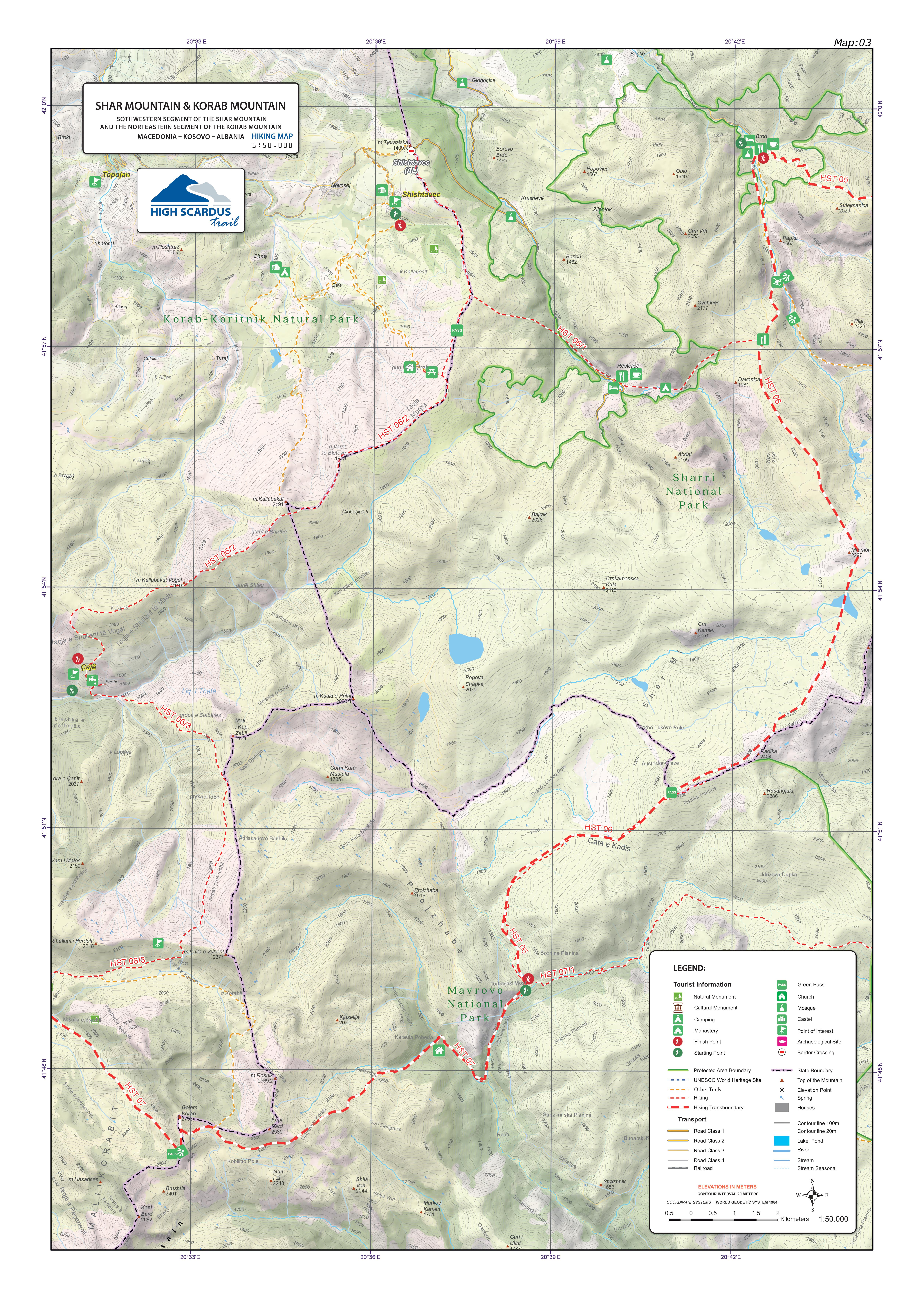
Starting point:
- Torbeshki Most
Description of the trail:
The trail is one of the most visited trails in the Mavrovo National Park because of the peak, Golem Korab, (2,753m) which is the highest peak in the Republic of Macedonia and the Republic of Albania. This stage of the trail starts from the farm under Bozhina Planina located on the road from Strezimir towards the tripoint between Macedonia, Albania, and Kosovo and continues eastward along the River Adzhina and up to the place where the path diverges right towards the border post “Karaula Pobeda” and left towards Strezimir. Following the dirt road for approximately one kilometer, turning left after passing a concrete bridge and walking up for approximately ten meters leads into the yard of the border post “Karaula Pobeda” at altitude of 1,475m.
From here, the trail continues through beech forest until it reaches the sheep farm Belandja at altitude of 1,750m where the pastures begin to spread out. Above the sheep farm, at 1,860m, there is a spring, which is the last in this part of the mountain. The next spring is in the foothill of the Golem Korab peak. The trail is visible, easy to follow and marked.
From Kobilino Pole starts a southward traverse until reaching an altitude of 2,450m where a view towards Golem Korab, which is at 2,753m opens up. The climb towards this point is through the north – east slopes of the peak on a visible and marked trail. The descent is made through the western slopes of the peak until reaching the village of Radomirë. The trail passes through pastures and a small rocky part. While descending, several glacial lakes are can be seen and the trail is visible until entering the village of Radomirë.
Technical and touristic information:
Altitude of the starting point: Torbeshki Most – 1,331 m
Highest point: Korab – 2,753 m
Altitude of the ending point: The village of Radomirë – 1,265 m
Altitude difference: 1,433 m
Duration of the hiking tour: 8.00 – 10.00 hours
Length of the tour: 23 km
Difficulty of the tour: ☆ ☆ ☆ ☆ ☆
Required fitness level: ☆ ☆ ☆ ☆ ☆
Panoramas and landscapes:
- View from Kobilino Pole (2,380m) – a beautiful panorama of the surrounding peaks (Ribnichka skala, Kabash, Mal Korab, Dlaboka Reka, Mavrovo Lake, Stogovo, Bistra, Deshat, and Shar Mountain).
- The view from the top is unforgettable, with favourable weather conditions allowing for a view that stretches westward as far as the peaks of Rila Mountain and Pirin and eastward to the peaks of the Prokletie Mountain.
- Descending towards the village of Radomirë, the populated places in the foothill of Korab in Albania can be seen to the west.
Access to the starting point:
- Highway Skopje – Mavrovo, 88 km
- Local road Mavrovo – Nichpur – Torbeshki Most, 25 km
There is parking available for a large number of vehicles in the farm near the River Radika on Torbeshki Most.
Access to the ending point:
- Highway Tirana – Kukës, 145 km
- Local road Kukës – Radomirë, 45 km
There is parking available for a large number of vehicles in the village of Radomir.
Accommodation and food:
- The area offers numerous possibilities for enjoyment. Accommodation can be found in Mavrovo, Trnica, and Zhirovnica, where guest houses and restaurants are available, or a camping site near the milk farm close to the River Radika.
- Multiple options for accommodation in the village of Radomir.
- (41°48’58.00″N 20°29’6.03″E / 41.81611111, 20.48500000)


